Over the past year we have been inundated with requests regarding flight data related to the COVID-19 pandemic. While we have done our best to help researchers around the world using our trusted Impala shell, we have also released a public version of the flight meta data that we have collected over the whole year of 2020 plus the whole year of 2019 for a pre-COVID-19 comparison. If you are only interested in the data, you can find it over at CERN's Zenodo repository: https://doi.org/10.5281/zenodo.3737101
We currently plan to update this dataset monthly during the pandemic. If you have research needs that go beyond this release model, you can apply for full data access with us.
Edit May 2023: We stopped updating the dataset after December 2022. Previous files have been fixed after a thorough sanity check. This is now the final and stable version of all flight metadata from 2019-2022.
The main use cases of flight data related to the pandemic are manifold: First, flight data can be used as input for models analysing and predicting the global spread of the virus. Second, flights as an indicator of economic activity can provide insights into the impact of the pandemic on both countries' economies in general and the aviation industry in particular. Finally, the data has become popular for analysis in Earth Systems Sciences over the course of the year. We have a pre-print discussing this here. [1] The data in this dataset is derived and cleaned from the full OpenSky dataset and made fully publicly available for the first time. It spans metadata for all flights seen by the network's more than 3500 members in 2019 and 2020.
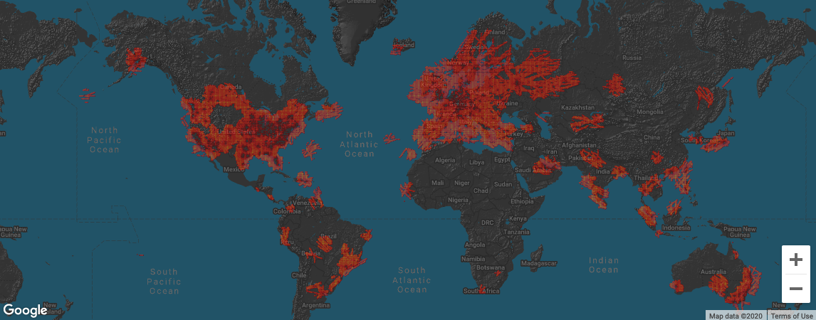
The most important point to remember is that as these data are derived from our awesome feeders, we cannot provide every global flight movement in our dataset but only those ADS-B-equipped aircraft seen within our coverage!
An overview of our coverage is provided for any given day on our Facts page. An example for yesterday (2020-04-02) is shown here:

If you have access to a place that is not yet covered by OpenSky and want to see researchers include that area in the future, please do provide a feed!
[1] Strohmeier, M., Olive, X., Lübbe, J., Schäfer, M., and Lenders, V.: Crowdsourced Air Traffic Data from the OpenSky Network 2019–20, Earth Syst. Sci. Data. [preprint], 2021.
Usage Examples & Tools
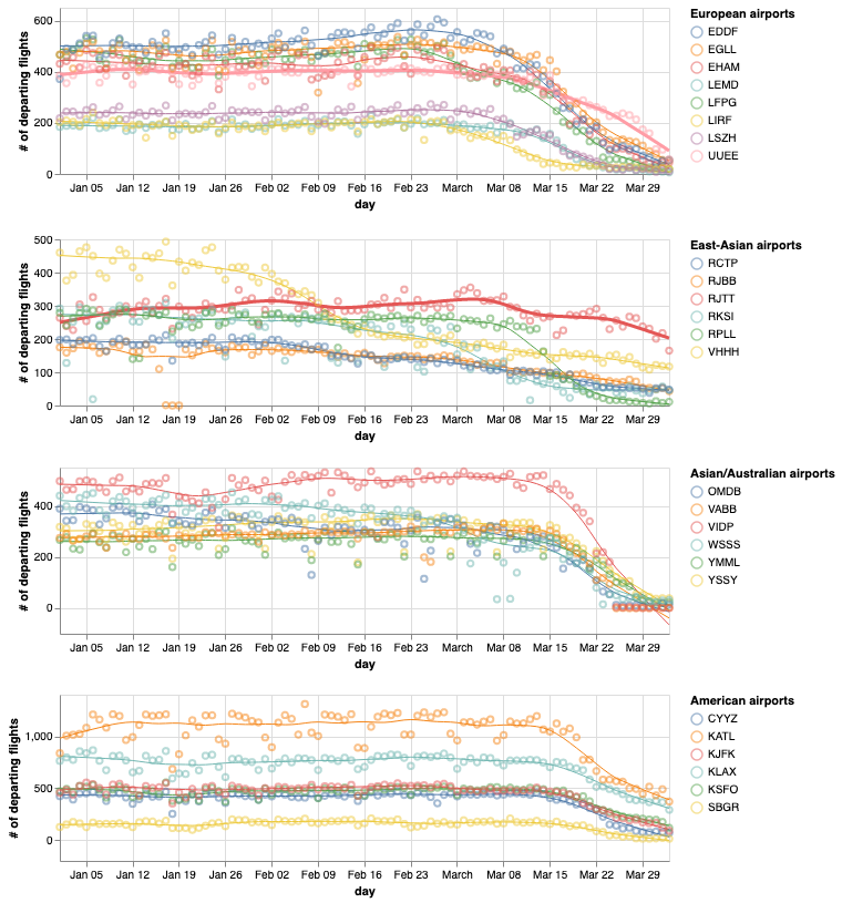
Xavier Olive from ONERA has made some initial plots using this dataset, illustrating for example the drop in air traffic at specific airports during the early phase of the pandemic:

More up-to-date visualisations and code for use with this dataset can be found over at Impact of COVID-19 on worldwide aviation.
Since the dataset is naturally large, we recommend using tools such as R, Python or Matlab for processing vast quantities of data. You can find more tools, that interface directly with our Live API and our Impala shell on our data tools subpage.
If you want to split these files into smaller .csv files before loading them into your preferred processing programme, we recommend using CSV Splitter (Windows) or the Linux/MacOS split command.


